Sample Projects
Since opening in 1999, IR has taken on a wide range of work from clients in
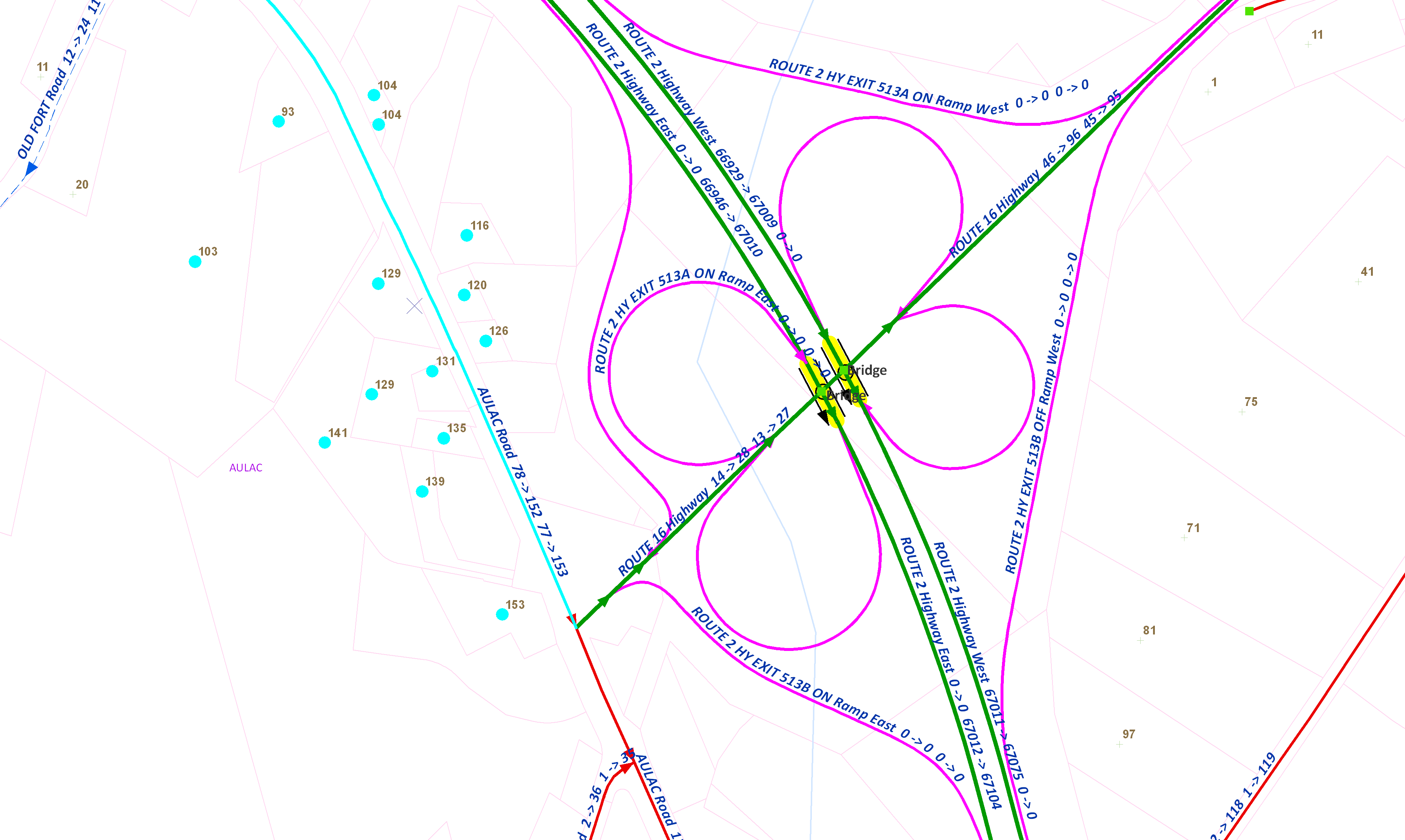
government, emergency response, private industry, and not-for-profit organizations. Following is a sample of projects that we have been involved in.Enhancement and Maintenance of Ambulance Dispatch Road Databases
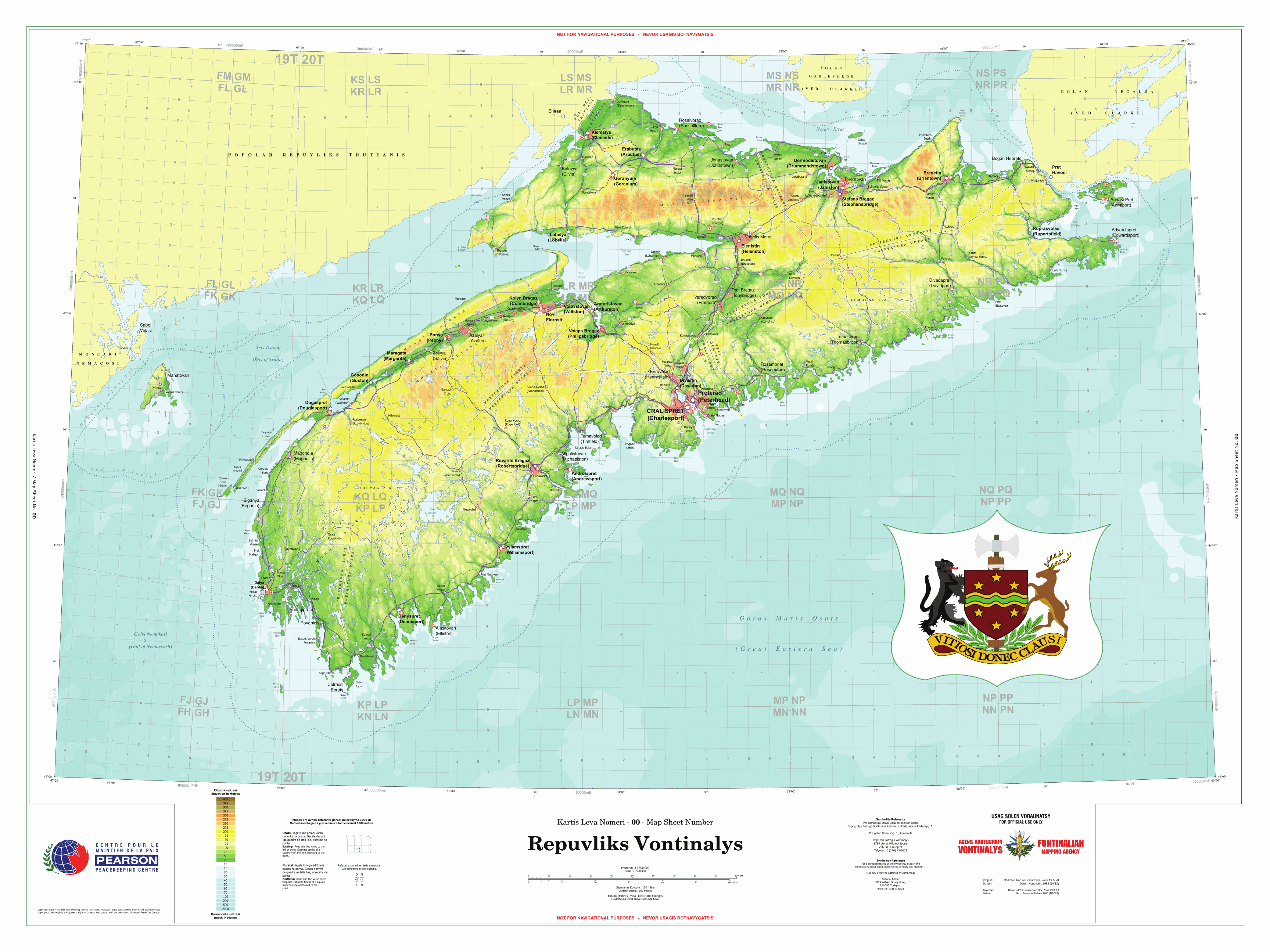
Creation of Fictional Maps for Training Exercises
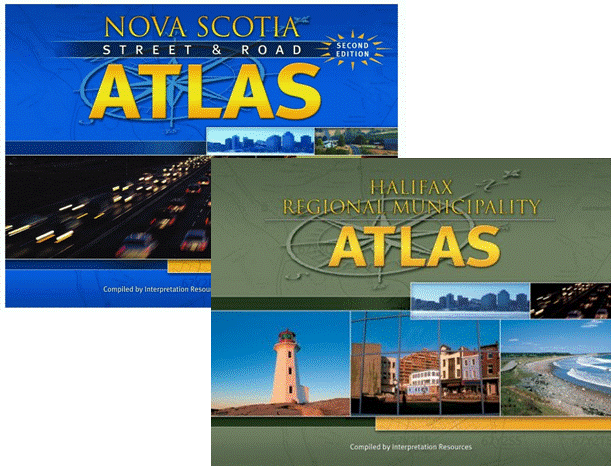
Atlas Publications
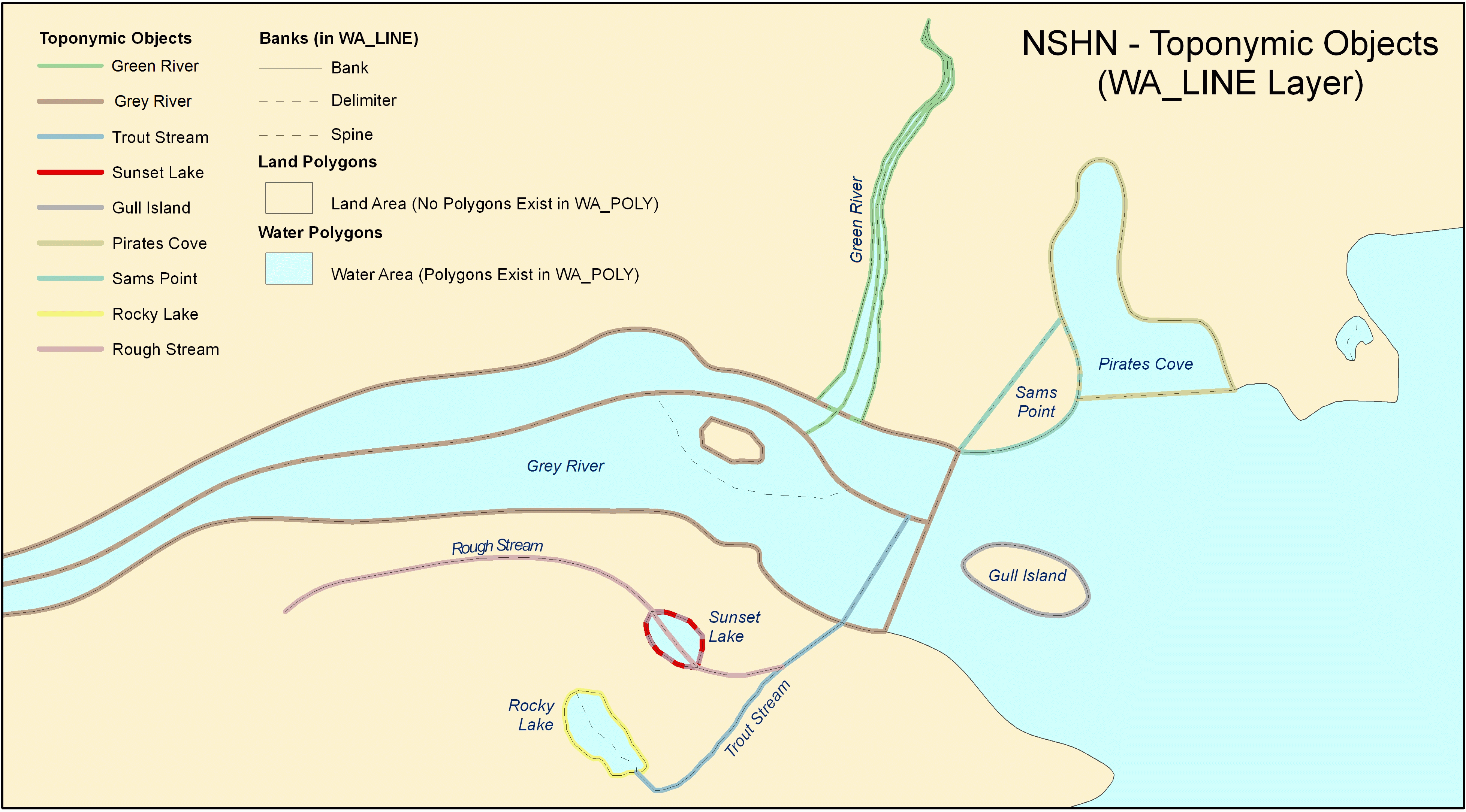
Enhancement and Quality Control of the Nova Scotia Hydrographic Network (NSHN)
GIS Infrastructure Analysis
Research and Development Projects
In addition to these projects, IR has also worked on:
NS Geopolitical Boundaries
Developed strategies to help implement the Nova Scotia Geopolitical Boundaries Project. The goal of this project was to create a single mapping database representation of the geopolitical boundaries (provincial, county, municipal) within Nova Scotia.
Metadata
Involved with the development, implementation, and population of the Nova Scotia metadata initiative through GeoNOVA. Highlights included the development of a metadata user manual and online help manual, training users on the metadata application, and usability testing.
Geospatial Infrastructure Design
Working with partner companies, the computing network and environments for a provincial government geomatics program were designed. IR facilitated information gathering workshops with government agencies to determine their current and future GIS needs. The information gathered was summarized and documented for the Geospatial Infrastructure Design.
Canadian Geospatial Data Infrastructure (CGDI) Interoperability Project
To meet the Canadian Geospatial Consortium specifications, this project standardized the way information in many of the Client's geographic databases was stored, accessed, and presented online. It involved converting spatial data from Spatial Database Engines (SDE) to ESRI shapefiles. Web Feature Services (WFS) were then developed to allow online users to access this spatial data in a XML based format called Geography Markup Language (GML).
Road Name Reconciliation
This project involved working with the Nova Scotia Department of Transportation and Infrastructure Renewal, EMO, and SMS to establish official road names and all associated aliases. This was done through a reconciliation process with various databases and on-ground signage.
Customized Mapping Application
Replaced an outdated mapping application with a new, enhanced modern mapping application. Programs for migrating the client's spatial data were developed. Upon implementation, training was provided and a customized user manual developed.
Civic Addressing
Work included the design and structure enhancements to an Oracle« database, development of an online maintenance update tool, creation of a desktop application for editing roads, and performing quality control routines using ESRI« GIS development component MapObjects«.
Community Signage Study
This project was a comprehensive study in Hants County and Lunenburg Municipality that determined what community signs should look like, where they should be placed, and what buffering tolerance or other factors should be considered. IR also identified present spelling errors and community signs now on the ground that should be removed.
Online Mapping Application for Mobile Devices
Developed and implemented an online mapping application for use on mobile devices. This project is unique in that it developed a server-side web application that is accessed using a mobile device's browser, rather than an application built for a specific device that must be developed.
Site Selection Website
Designed and developed an online mapping application for retrieving information about geographic areas. It was used by site selectors and potential investors from around the world looking for possible sites to locate businesses.
Database System Development
A SQL Server GIS database was developed that incorporates and manages a number of the Client's geographic databases. Work included developing a central SQL database linked to existing database and documents, updating and developing GUIs, and producing a procedural manual.
Community Group Website
Developed a community group website that displays geographic data using ArcIMS and Web Map Services (WMS). Online users can view an interactive map along with density and area calculations for each community. Enhanced navigation tools were built for the online maps.
Nonresident Ownership
A provincial property records database has been processed and analyzed to determine the extent of nonresident ownership.
Air Photo System
Designed and developed a system that allows aerial photography orders to be managed electronically at all stages of the processing, replacing their paper predecessors.
Air Photo Interactive Index System
Developed an interactive index system featuring photo previews and a county map of flight lines.
Broadband Coverage Map
Developed a large-scale map detailing the availability of Broadband Internet coverage.
Waterfront Ownership
Developed and delivered a map series that summarized waterfront ownership using ESRI« GIS software ArcGIS«.
Community Research
Developed a series of maps in support of a community research study.
Municipal Electoral Districts Website
Designed and developed an online mapping application for retrieving information about local electoral districts. An internet-based ASP.NET update system was also developed for authorized users.
Business Directory
Designed and developed a web-based business directory.
Web Map Services (WMS)
Improved the performance and speed of WMS on a geographic information website by converting existing data and cartographic information to more efficient formats. A WMS was also developed to increase the number of datasets available on this site.